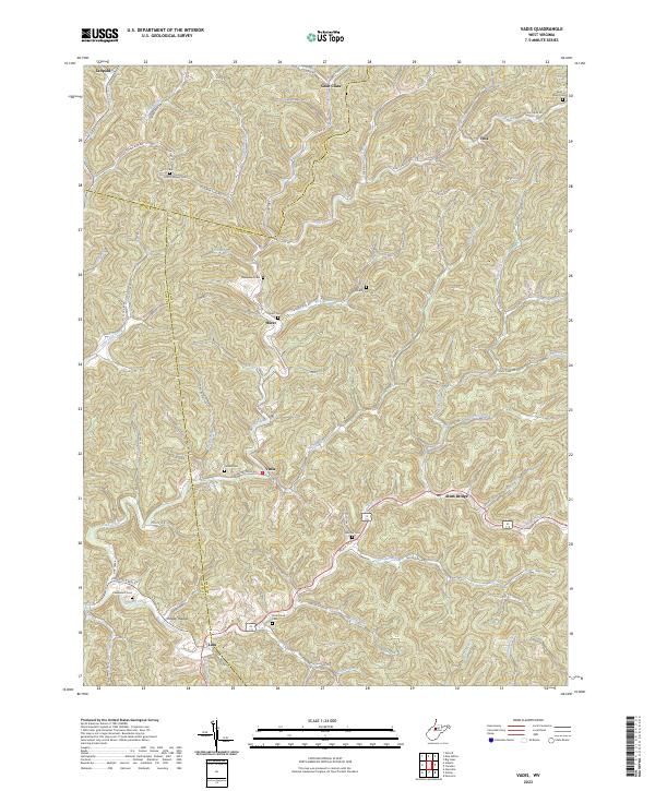
2023 Map of Vadis
USGS Topo · Published 2023About this map
Saint Clara and Leopold anchor the northern reaches of this rural landscape, where the borders of Doddridge, Gilmer, and Lewis counties converge. The terrain is defined by an intricate network of narrow valleys carved by Fink Creek, Leading Creek, and Alum Fork, creating a pattern of settlement that follows the winding watercourses and hollows. Small communities like Vadis, Hurst, and Linn appear as centers of local life, connected by a web of county roads such as the Linn-Cox S Mills route and Fink Creek Rd. The map reveals a high density of family and community burial grounds, including Halderman Cem, Rock Grove Cem, and Woofter Cem, which serve as vital markers for genealogical research in this part of West Virginia. From the secluded pockets of Happy Hollow to the junction at Alum Bridge, the map preserves the enduring rural character of these Appalachian highlands.
Find a feature on this map
79 named features on this map. Tap any name to fly to it.
Don’t see what you’re looking for? This feature index may not catch every label — zoom into the map to look around manually.
Map Details
Editions of this 2023 Vadis Map
This is the sole edition of this map. No revisions or reprints were ever made.
Other maps of this area

1893 · Sutton
USGS Topo · 1:125,000

1904 · Vadis
USGS Topo · 1:62,500

1906 · Holbrook
USGS Topo · 1:62,500

1906 · Glenville
USGS Topo · 1:62,500

1906 · Burnsville
USGS Topo · 1:62,500

1924 · Holbrook
USGS Topo · 1:62,500

1925 · Glenville
USGS Topo · 1:62,500

1925 · Burnsville
USGS Topo · 1:62,500

1925 · Vadis
USGS Topo · 1:62,500

1926 · Holbrook
USGS Topo · 1:62,500