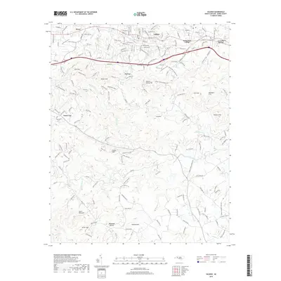
2019 Map of Valdese
USGS Topo · Published 2019About this map
Valdese and Rutherford College anchor the northern landscape of this Burke County survey, where the Piedmont begins its ascent into the South Mountains. The terrain transitions from the developed corridors of Drexel and Connelly Springs into a more complex network of ridges and watercourses. Distinctive peaks like Mineral Springs Mtn, Smith Mtn, and Hildebran Mtn dominate the central and eastern sections, while the southern reaches are defined by the winding path of Henry Fork and Abee Creek.
Find a feature on this map
188 named features on this map. Tap any name to fly to it.
Don’t see what you’re looking for? This feature index may not catch every label — zoom into the map to look around manually.
Map Details
Editions of this 2019 Valdese Map
This is the sole edition of this map. No revisions or reprints were ever made.
Other maps of this area

1895 · Hickory
USGS Topo · 1:125,000

1905 · Morganton
USGS Topo · 1:125,000

1953 · Charlotte
USGS Topo · 1:250,000

1954 · Charlotte
USGS Topo · 1:250,000

1956 · Valdese
USGS Topo · 1:24,000

1956 · Benn Knob
USGS Topo · 1:24,000

1956 · Morganton North
USGS Topo · 1:24,000

1956 · Casar
USGS Topo · 1:24,000

1956 · Morganton South
USGS Topo · 1:24,000

1956 · Drexel
USGS Topo · 1:24,000