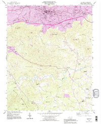
1993 Map of Valdese
USGS Topo · Published 1996About this map
Valdese and the neighboring textile and furniture corridor of the western Piedmont are captured during a period of urban expansion in the early 1990s. The map illustrates the transition from the industrial valley floor to the foothills, where the South Mountains rise to the south. Numerous small congregations like Bollingers Chapel, Abees Grove Ch, and Walker Chapel are scattered throughout the rural landscape, indicating the importance of local community hubs in this part of Burke County.
Find a feature on this map
50 named features on this map. Tap any name to fly to it.
Don’t see what you’re looking for? This feature index may not catch every label — zoom into the map to look around manually.
Map Details
Editions of this 1993 Valdese Map
This is the sole edition of this map. No revisions or reprints were ever made.
Other maps of this area

1895 · Hickory
USGS Topo · 1:125,000

1905 · Morganton
USGS Topo · 1:125,000

1953 · Charlotte
USGS Topo · 1:250,000

1954 · Charlotte
USGS Topo · 1:250,000

1956 · Valdese
USGS Topo · 1:24,000

1956 · Benn Knob
USGS Topo · 1:24,000

1956 · Morganton North
USGS Topo · 1:24,000

1956 · Casar
USGS Topo · 1:24,000

1956 · Morganton South
USGS Topo · 1:24,000

1956 · Drexel
USGS Topo · 1:24,000