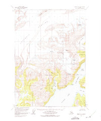
1960 Map of Valdez A-8
USGS Topo · Published 1975About this map
Ice and water dominate this coastal Alaska landscape within the Chugach National Forest, where the massive Columbia Glacier meets Columbia Bay. This survey captures the region as it appeared in 1960, detailing a complex network of moving ice including the Shoup Glacier, Anderson Glacier, and the Westbrook Glacier. The topography is defined by high peaks like Mount Cameron and Divider Mtn, with a network of crevasses and high mountain passes such as Anderson Pass.
Find a feature on this map
40 named features on this map. Tap any name to fly to it.
Don’t see what you’re looking for? This feature index may not catch every label — zoom into the map to look around manually.
Map Details
Editions of this 1960 Valdez A-8 Map
3 editions found

Other maps of this area

1948 · Cordova
USGS Topo · 1:250,000

1950 · Cordova D-7
USGS Topo · 1:63,360

1951 · Seward
USGS Topo · 1:250,000

1951 · Anchorage
USGS Topo · 1:250,000

1951 · Cordova
USGS Topo · 1:250,000

1951 · Seward D-1
USGS Topo · 1:63,360

1951 · Cordova D-8
USGS Topo · 1:63,360

1952 · Valdez
USGS Topo · 1:250,000

1952 · Seward D-1
USGS Topo · 1:63,360

1952 · Cordova D-8
USGS Topo · 1:63,360