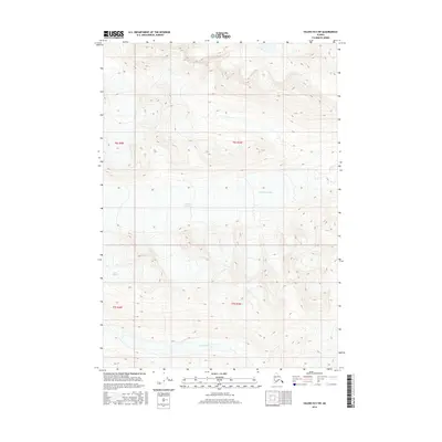
2016 Map of Valdez B-5 SW
USGS Topo · Published 2016About this map
Tonsina Glacier and the Ted Stevens Icefield dominate this glaciated landscape in the Chugach Mountains region. This 2016 survey documents a high-altitude wilderness defined by massive ice flowages and the headwaters of the Tsina River. The map provides a precise record of ice extent and topographical relief near the transition between t6s r3w and t7s r4w, where the Tsina Glacier carves through the southern portion of the quadrangle. For those studying the hydrology of the Unorganized Borough, the proximity of these major ice fields to the active river drainage illustrates the modern state of Alaska's interior glacial systems.
Find a feature on this map
8 named features on this map. Tap any name to fly to it.
Don’t see what you’re looking for? This feature index may not catch every label — zoom into the map to look around manually.
Map Details
Editions of this 2016 Valdez B-5 SW Map
This is the sole edition of this map. No revisions or reprints were ever made.
Other maps of this area

1951 · Valdez B-5
USGS Topo · 1:63,360

1951 · Valdez B-6
USGS Topo · 1:63,360

1951 · Valdez A-6
USGS Topo · 1:63,360

1952 · Valdez
USGS Topo · 1:250,000

1952 · Valdez A-6
USGS Topo · 1:63,360

1953 · Valdez B-6
USGS Topo · 1:63,360

1953 · Valdez A-5
USGS Topo · 1:63,360

1960 · Valdez
USGS Topo · 1:250,000
1993 · Valdez B-6
USGS Topo · 1:63,360
1995 · Valdez B-5
USGS Topo · 1:63,360