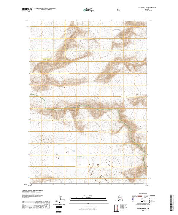
2023 Map of Valdez B-8 NW
USGS Topo · Published 2023About this map
Chugach National Forest encompasses the southern half of this landscape, where the massive Columbia Glacier and Science Glacier dominate the high-altitude topography. The terrain is defined by a series of prominent summits including Mt Haley, Flat Top Peak, and Mt Powder Top, which follow a ridgeline marking the transition between the glaciated valleys. The map illustrates the boundary between Matanuska-Susitna and Copper River Counties, providing a detailed look at the drainage patterns and ice fields before they meet the coastline further south. This survey captures the specialized geomorphology of the Alaskan wilderness, where elevation changes are swift and permanent ice features dictate the character of the land.
Find a feature on this map
13 named features on this map. Tap any name to fly to it.
Don’t see what you’re looking for? This feature index may not catch every label — zoom into the map to look around manually.
Map Details
Editions of this 2023 Valdez B-8 NW Map
This is the sole edition of this map. No revisions or reprints were ever made.
Other maps of this area

1951 · Anchorage
USGS Topo · 1:250,000

1952 · Valdez
USGS Topo · 1:250,000

1960 · Anchorage B-1
USGS Topo · 1:63,360

1960 · Valdez B-8
USGS Topo · 1:63,360

1960 · Valdez C-8
USGS Topo · 1:63,360

1960 · Anchorage C-1
USGS Topo · 1:63,360

1960 · Valdez
USGS Topo · 1:250,000

1962 · Anchorage
USGS Topo · 1:250,000

1979 · Anchorage
USGS Topo · 1:250,000
1993 · Valdez C-8
USGS Topo · 1:63,360