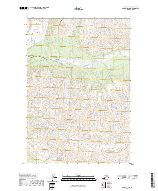
2023 Map of Valdez C-1 NE
USGS Topo · Published 2023About this map
Alice Peak and Sheep Mtn rise above a complex hydrological network in the high Wrangell Mountains. This 2023 survey documents a remote landscape where the Kotsina River and its numerous tributaries, including Clear Creek and Sheep Creek, carve through the glacial terrain. The Kotsina River Trl provides a rare point of human passage through the protected lands of the Wrangell-Saint Elias National Preserve and the Wrangell-St. Elias Wilderness. In the southern portion of the map, drainage patterns are defined by Elliott Creek, Castle Creek, and Deception Creek, while the massive Long Glacier dominates the northwestern corner. The topography illustrates the sharp elevation changes between peaks and the deep river valleys that define this section of the Copper River Census Area.
Find a feature on this map
35 named features on this map. Tap any name to fly to it.
Don’t see what you’re looking for? This feature index may not catch every label — zoom into the map to look around manually.
Map Details
Editions of this 2023 Valdez C-1 NE Map
This is the sole edition of this map. No revisions or reprints were ever made.
Other maps of this area

1951 · McCarthy
USGS Topo · 1:250,000

1951 · McCarthy C-8
USGS Topo · 1:63,360

1951 · Valdez C-1
USGS Topo · 1:63,360

1952 · Valdez
USGS Topo · 1:250,000

1953 · Valdez C-1
USGS Topo · 1:63,360

1959 · Valdez D-1
USGS Topo · 1:63,360

1960 · McCarthy D-8
USGS Topo · 1:63,360

1960 · McCarthy
USGS Topo · 1:250,000

1960 · Valdez
USGS Topo · 1:250,000
1995 · McCarthy C-8
USGS Topo · 1:63,360