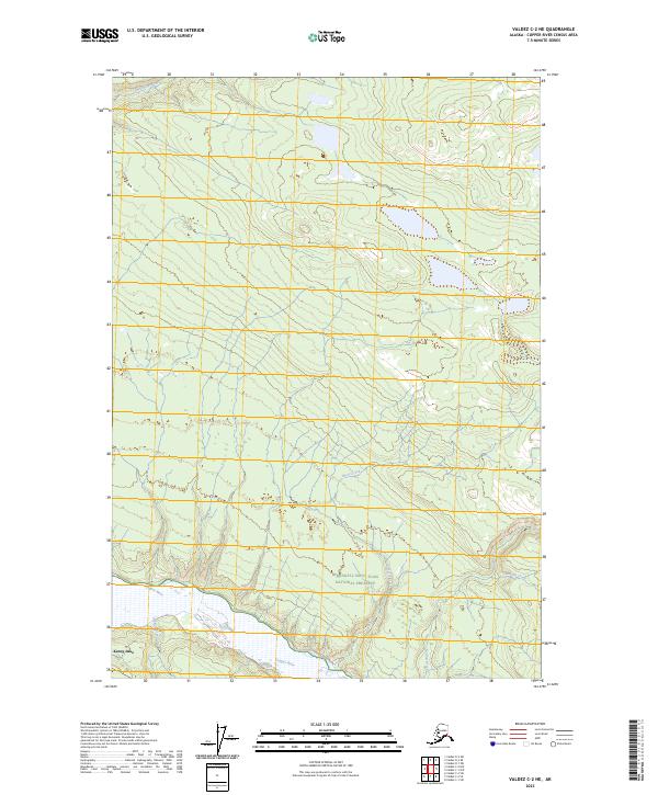
2023 Map of Valdez C-2 NE
USGS Topo · Published 2023About this map
Kenny Lake serves as a primary reference point in this Copper River basin landscape, where the confluence of glacial waters and vast northern wilderness meets modern land management. The Copper River forms a dominant natural boundary along the southern edge of the sheet, fed by a network of drainage systems including Liberty Creek and the meandering Cheshnina River. This terrain is significantly shaped by the presence of the Wrangell-Saint Elias National Preserve, illustrating the intersection of conserved wilderness and the dispersed settlement patterns typical of this interior region. Smaller tributaries like Horse Creek, Kuslina Creek, and Rabbit Creek vein through the high-latitude environment, providing a detailed look at the hydrology that supports the local ecosystem and the community at Kenny Lake.
Find a feature on this map
14 named features on this map. Tap any name to fly to it.
Don’t see what you’re looking for? This feature index may not catch every label — zoom into the map to look around manually.
Map Details
Editions of this 2023 Valdez C-2 NE Map
This is the sole edition of this map. No revisions or reprints were ever made.
Other maps of this area

1951 · Valdez C-2
USGS Topo · 1:63,360

1951 · Valdez C-1
USGS Topo · 1:63,360

1952 · Valdez
USGS Topo · 1:250,000

1953 · Valdez C-2
USGS Topo · 1:63,360

1953 · Valdez C-1
USGS Topo · 1:63,360

1959 · Valdez D-2
USGS Topo · 1:63,360

1959 · Valdez D-1
USGS Topo · 1:63,360

1960 · Valdez
USGS Topo · 1:250,000
1996 · Valdez D-1
USGS Topo · 1:63,360

1996 · Valdez C-2
USGS Topo · 1:63,360