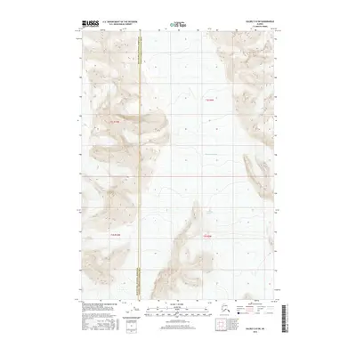
2016 Map of Valdez C-8 SW
USGS Topo · Published 2016About this map
The Nelchina Glacier and the Ted Stevens Icefield dominate this high-altitude landscape along the border of the Matanuska-Susitna Borough and the Valdez-Cordova Census Area. This topographic study reveals a terrain shaped entirely by ice and elevation, where contour lines tightly trace the steep ascents surrounding these massive glacial features. The map provides a precise record of the ice margins and drainage patterns as they existed in the early 21st century, offering critical data for those studying Alaskas shifting glaciology. Aside from the administrative boundary line cutting through the mountains, the area remains an undeveloped expanse defined by the flow of ice and the sharp relief of the unnamed peaks within the t3s r9w and t4s r9w townships.
Find a feature on this map
7 named features on this map. Tap any name to fly to it.
Don’t see what you’re looking for? This feature index may not catch every label — zoom into the map to look around manually.
Map Details
Editions of this 2016 Valdez C-8 SW Map
This is the sole edition of this map. No revisions or reprints were ever made.
Other maps of this area

1951 · Anchorage
USGS Topo · 1:250,000

1952 · Valdez
USGS Topo · 1:250,000

1960 · Anchorage B-1
USGS Topo · 1:63,360

1960 · Valdez B-8
USGS Topo · 1:63,360

1960 · Valdez C-8
USGS Topo · 1:63,360

1960 · Anchorage C-1
USGS Topo · 1:63,360

1960 · Valdez
USGS Topo · 1:250,000

1962 · Anchorage
USGS Topo · 1:250,000

1979 · Anchorage
USGS Topo · 1:250,000
1993 · Valdez C-8
USGS Topo · 1:63,360