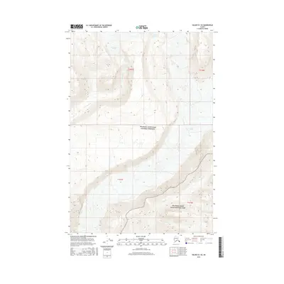
2016 Map of Valdez D-1 SE
USGS Topo · Published 2016About this map
Wrangell-Saint Elias National Preserve and Wrangell-Saint Elias National Park define this interior Alaskan landscape, where glacial activity dictates the geography. The high-altitude terrain is dominated by the Cheshnina Glacier and the Long Glacier, which serve as the headwaters for the surrounding drainage systems. The Cheshnina River carries glacial melt through the western portion of the quadrangle, while Limestone Cr and Clear Cr flow through the southern and eastern sectors. This 2016 survey illustrates the intersection of federal protected lands and the raw glacial environment, providing a detailed record of ice margins and stream paths within the Unorganized Borough. It is an essential document for understanding the hydrologic patterns of the Copper River basin at this moment in the early 21st century.
Find a feature on this map
11 named features on this map. Tap any name to fly to it.
Don’t see what you’re looking for? This feature index may not catch every label — zoom into the map to look around manually.
Map Details
Editions of this 2016 Valdez D-1 SE Map
This is the sole edition of this map. No revisions or reprints were ever made.
Other maps of this area

1951 · McCarthy
USGS Topo · 1:250,000

1951 · McCarthy C-8
USGS Topo · 1:63,360

1951 · Valdez C-1
USGS Topo · 1:63,360

1952 · Valdez
USGS Topo · 1:250,000

1953 · Valdez C-1
USGS Topo · 1:63,360

1959 · Valdez D-1
USGS Topo · 1:63,360

1960 · McCarthy D-8
USGS Topo · 1:63,360

1960 · McCarthy
USGS Topo · 1:250,000

1960 · Valdez
USGS Topo · 1:250,000
1995 · McCarthy C-8
USGS Topo · 1:63,360