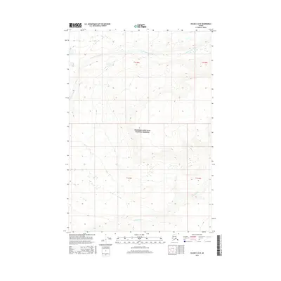
2016 Map of Valdez D-2 SE
USGS Topo · Published 2016About this map
Wrangell-Saint Elias National Preserve occupies the central and southern portions of this landscape, marking a protected wilderness defined by glacial drainage patterns. The hydrology of the area is dominated by the East Fork Chetaslina River flowing westward across the northern sections, joined by tributaries like the E Fork Chetaslina River. To the south, the Cheshnina River cuts through the preserve, its braided channel indicating the dynamic nature of Alaskan river systems. This 2016 survey illustrates the high-elevation terrain of the interior, where steep contour gradients rise sharply from the river valleys. The map serves as a precise record of the remote glacial-fed waterways within the Copper River basin drainage system.
Find a feature on this map
8 named features on this map. Tap any name to fly to it.
Don’t see what you’re looking for? This feature index may not catch every label — zoom into the map to look around manually.
Map Details
Editions of this 2016 Valdez D-2 SE Map
This is the sole edition of this map. No revisions or reprints were ever made.
Other maps of this area

1951 · Valdez C-2
USGS Topo · 1:63,360

1951 · Valdez C-1
USGS Topo · 1:63,360

1952 · Valdez
USGS Topo · 1:250,000

1953 · Valdez C-2
USGS Topo · 1:63,360

1953 · Valdez C-1
USGS Topo · 1:63,360

1959 · Valdez D-2
USGS Topo · 1:63,360

1959 · Valdez D-1
USGS Topo · 1:63,360

1960 · Valdez
USGS Topo · 1:250,000
1996 · Valdez D-1
USGS Topo · 1:63,360

1996 · Valdez C-2
USGS Topo · 1:63,360