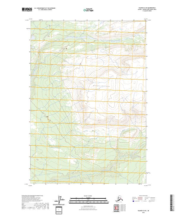
2023 Map of Valdez D-2 SE
USGS Topo · Published 2023About this map
Glacial waters and towering peaks dominate this portion of the Wrangell Mountains, situated within the expansive protection of the Wrangell-St. Elias Wilderness and the Wrangell-Saint Elias National Preserve. The landscape is defined by the complex drainage patterns of the East Fork Chetaslina River in the north and the Cheshnina River to the south. This recent topographic survey reveals a rugged interior devoid of roads or settlements, where the primary organizational structures are the public land survey system lines of t1n r5e and t1s r6e. The map serves as a detailed record of high-altitude hydrology and the sharp relief of the Wrangell range, capturing a wilderness where natural boundaries far outweigh human ones.
Find a feature on this map
9 named features on this map. Tap any name to fly to it.
Don’t see what you’re looking for? This feature index may not catch every label — zoom into the map to look around manually.
Map Details
Editions of this 2023 Valdez D-2 SE Map
This is the sole edition of this map. No revisions or reprints were ever made.
Other maps of this area

1951 · Valdez C-2
USGS Topo · 1:63,360

1951 · Valdez C-1
USGS Topo · 1:63,360

1952 · Valdez
USGS Topo · 1:250,000

1953 · Valdez C-2
USGS Topo · 1:63,360

1953 · Valdez C-1
USGS Topo · 1:63,360

1959 · Valdez D-2
USGS Topo · 1:63,360

1959 · Valdez D-1
USGS Topo · 1:63,360

1960 · Valdez
USGS Topo · 1:250,000
1996 · Valdez D-1
USGS Topo · 1:63,360

1996 · Valdez C-2
USGS Topo · 1:63,360