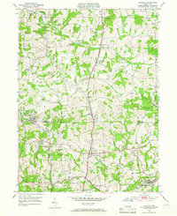
1950 Map of Valencia
USGS Topo · Published 1966About this map
The Baltimore and Ohio railroad corridor anchors this mid-century view of the borderlands between Butler and Allegheny counties. This transition from agricultural land to burgeoning suburban and industrial centers is marked by several notable institutions, including the Lilian Home Heart House in Valencia and the St Barnabas Home near Richland Sch. The landscape is defined by the winding paths of Glade Run and Deer Creek, which historically dictated the placement of settlements like Glade Mills and Bairdford.
Find a feature on this map
35 named features on this map. Tap any name to fly to it.
Don’t see what you’re looking for? This feature index may not catch every label — zoom into the map to look around manually.
Map Details
Editions of this 1950 Valencia Map
5 editions found
Other maps of this area

1906 · Sewickley
USGS Topo · 1:62,500

1908 · Sewickley
USGS Topo · 1:62,500

1908 · New Kensington
USGS Topo · 1:62,500

1908 · Zelienople
USGS Topo · 1:62,500

1909 · Butler
USGS Topo · 1:62,500

1910 · New Kensington
USGS Topo · 1:62,500

1910 · Zelienople
USGS Topo · 1:62,500

1911 · Butler
USGS Topo · 1:62,500

1950 · Valencia
USGS Topo · 1:24,000

1951 · Canton
USGS Topo · 1:250,000