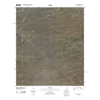
2010 Map of Valentine East
USGS Topo · Published 2010About this map
Valentine stands as the primary hub in this arid Jeff Davis County landscape, where the town's small grid is bisected by N Main St and surrounded by a network of cattle-country corridors. The terrain is defined by dry watercourses like Moore Slough and the drainage of Wood Canyon and Merrill Canyon to the east. Isolated infrastructure, essential for ranching in the High Desert, is marked by features like One Lung Windmill and Bell Place Windmill. These landmarks, along with named routes such as Alfred Means Ranch Rd and Old Brite Rd, underscore the sprawling nature of land ownership and the importance of water access in the region. The map also identifies the locality of Quebec along the main transit line, showing the sparse but vital settlement pattern that characterizes this portion of the Trans-Pecos.
Find a feature on this map
12 named features on this map. Tap any name to fly to it.
Don’t see what you’re looking for? This feature index may not catch every label — zoom into the map to look around manually.
Map Details
Editions of this 2010 Valentine East Map
This is the sole edition of this map. No revisions or reprints were ever made.
Other maps of this area

1892 · Chispa
USGS Topo · 1:125,000

1894 · Valentine
USGS Topo · 1:125,000

1895 · Chispa
USGS Topo · 1:125,000

1895 · Marfa
USGS Topo · 1:125,000

1896 · San Carlos
USGS Topo · 1:125,000

1897 · Valentine
USGS Topo · 1:125,000

1897 · Chispa
USGS Topo · 1:125,000

1943 · Valentine
USGS Topo · 1:125,000

1959 · Marfa
USGS Topo · 1:250,000

1965 · Marfa
USGS Topo · 1:250,000