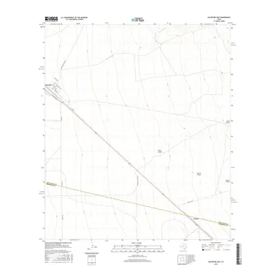
2016 Map of Valentine East
USGS Topo · Published 2016About this map
The high desert village of Valentine anchors the northwest corner of this West Texas survey, where the grid of streets like Texas Ave and California Ave meet the long diagonal of N Main St. This remote outpost, situated in the Trans-Pecos region, marks a transition from the structured township into the wide-open ranching country of the Chihuahuan Desert. To the southeast lies the settlement of Quebec, positioned along the same critical transportation corridor that defines the movement of people and goods through the high plains of Jeff Davis and Presidio Counties.
Find a feature on this map
20 named features on this map. Tap any name to fly to it.
Don’t see what you’re looking for? This feature index may not catch every label — zoom into the map to look around manually.
Map Details
Editions of this 2016 Valentine East Map
This is the sole edition of this map. No revisions or reprints were ever made.
Other maps of this area

1892 · Chispa
USGS Topo · 1:125,000

1894 · Valentine
USGS Topo · 1:125,000

1895 · Chispa
USGS Topo · 1:125,000

1895 · Marfa
USGS Topo · 1:125,000

1896 · San Carlos
USGS Topo · 1:125,000

1897 · Valentine
USGS Topo · 1:125,000

1897 · Chispa
USGS Topo · 1:125,000

1943 · Valentine
USGS Topo · 1:125,000

1959 · Marfa
USGS Topo · 1:250,000

1965 · Marfa
USGS Topo · 1:250,000