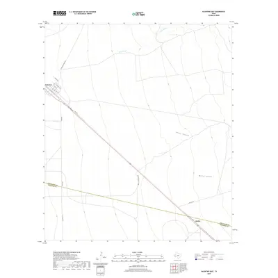
2019 Map of Valentine East
USGS Topo · Published 2019About this map
The high desert plains of the Trans-Pecos are anchored here by the village of Valentine, where a traditional street grid of avenues named for states, including Texas Ave and Kentucky Ave, meets the diagonal path of the Southern Pacific rail line and US Highway 90. This 2019 survey illustrates a landscape dominated by expansive ranching operations, with access provided by named routes such as Alfred Means Ranch Rd and Antelope Valley Rch Rd.
Find a feature on this map
21 named features on this map. Tap any name to fly to it.
Don’t see what you’re looking for? This feature index may not catch every label — zoom into the map to look around manually.
Map Details
Editions of this 2019 Valentine East Map
This is the sole edition of this map. No revisions or reprints were ever made.
Other maps of this area

1892 · Chispa
USGS Topo · 1:125,000

1894 · Valentine
USGS Topo · 1:125,000

1895 · Chispa
USGS Topo · 1:125,000

1895 · Marfa
USGS Topo · 1:125,000

1896 · San Carlos
USGS Topo · 1:125,000

1897 · Valentine
USGS Topo · 1:125,000

1897 · Chispa
USGS Topo · 1:125,000

1943 · Valentine
USGS Topo · 1:125,000

1959 · Marfa
USGS Topo · 1:250,000

1965 · Marfa
USGS Topo · 1:250,000