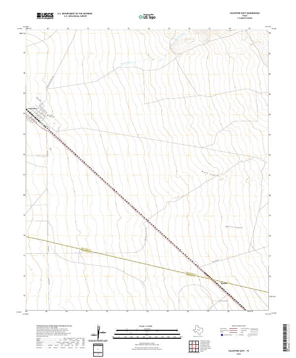
2022 Map of Valentine East
USGS Topo · Published 2022About this map
Valentine stands as a focal point of this Trans-Pecos landscape, with its residential grid extending from Kansas Ave to California Ave along the rail corridor. The community's local history is anchored by the Sacred Heart Cem on its eastern edge, while the surrounding high desert terrain is defined by drainage features like Moore Slough and the depressions of Wood Canyon and Merrill Canyon. Further southeast, the location of Quebec marks a secondary point along the transportation route near the border between Jeff Davis Co and Presidio Co. A network of ranch access roads, including Alfred Means Ranch Rd and Antelope Valley-Rch Rd, illustrates the sprawling agricultural footprint of the region, connecting remote properties back to the central hub at Valentine.
Find a feature on this map
23 named features on this map. Tap any name to fly to it.
Don’t see what you’re looking for? This feature index may not catch every label — zoom into the map to look around manually.
Map Details
Editions of this 2022 Valentine East Map
This is the sole edition of this map. No revisions or reprints were ever made.
Other maps of this area

1892 · Chispa
USGS Topo · 1:125,000

1894 · Valentine
USGS Topo · 1:125,000

1895 · Chispa
USGS Topo · 1:125,000

1895 · Marfa
USGS Topo · 1:125,000

1896 · San Carlos
USGS Topo · 1:125,000

1897 · Valentine
USGS Topo · 1:125,000

1897 · Chispa
USGS Topo · 1:125,000

1943 · Valentine
USGS Topo · 1:125,000

1959 · Marfa
USGS Topo · 1:250,000

1965 · Marfa
USGS Topo · 1:250,000