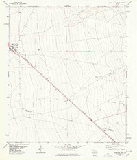
1978 Map of Valentine East
USGS Topo · Published 1978About this map
The town of Valentine serves as a focal point along the Southern Pacific railroad line in this 1978 survey of the high desert landscape. As the tracks cut diagonally across the terrain, they pass small railroad sidings and named locations like Quebec near the southern boundary. The presence of a High Sch and a local Cem within the town limits highlights the community's role as a regional center, even as the surrounding landscape is dominated by large-scale ranching and water infrastructure. Ranch life is evidenced by family-named landmarks and water sources such as the Bell Place Windmill, One Lung Windmill, and Red Well. The boundary between Jeff Davis Co Presidio Co runs through the lower third of the map, intersecting the drainages of Wood Canyon and Merrill Canyon as they reach toward the railroad corridor.
Find a feature on this map
19 named features on this map. Tap any name to fly to it.
Don’t see what you’re looking for? This feature index may not catch every label — zoom into the map to look around manually.
Map Details
Editions of this 1978 Valentine East Map
This is the sole edition of this map. No revisions or reprints were ever made.
Other maps of this area

1892 · Chispa
USGS Topo · 1:125,000

1894 · Valentine
USGS Topo · 1:125,000

1895 · Chispa
USGS Topo · 1:125,000

1895 · Marfa
USGS Topo · 1:125,000

1896 · San Carlos
USGS Topo · 1:125,000

1897 · Valentine
USGS Topo · 1:125,000

1897 · Chispa
USGS Topo · 1:125,000

1943 · Valentine
USGS Topo · 1:125,000

1959 · Marfa
USGS Topo · 1:250,000

1965 · Marfa
USGS Topo · 1:250,000