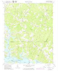
1963 Map of Valentines
USGS Topo · Published 1980About this map
The Virginia-North Carolina border bisects this landscape, dominated by the waters of Gaston Lake and the Roanoke River. The 1963 survey, updated with 1979 revisions, reveals the rural character of Brunswick County and Northampton County before modern development shifted the local footprint. Settlements like Valentines and Henrico serve as focal points for a network of country roads and remnants of an Old Railroad Grade that speaks to the area's former transportation corridors.
Find a feature on this map
47 named features on this map. Tap any name to fly to it.
Don’t see what you’re looking for? This feature index may not catch every label — zoom into the map to look around manually.
Map Details
Editions of this 1963 Valentines Map
4 editions found
Other maps of this area

1919 · White Plains
USGS Topo · 1:48,000

1919 · Emporia
USGS Topo · 1:62,500

1920 · White Plains
USGS Topo · 1:62,500

1942 · Emporia
USGS Topo · 1:62,500

1953 · Norfolk
USGS Topo · 1:250,000

1963 · Powellton
USGS Topo · 1:24,000

1963 · Barley
USGS Topo · 1:24,000

1963 · Gasburg
USGS Topo · 1:24,000

1963 · Ante
USGS Topo · 1:24,000

1963 · Valentines
USGS Topo · 1:24,000