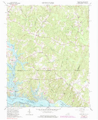
1963 Map of Valentines
USGS Topo · Published 1985About this map
The Roanoke River corridor and its transformed landscape define this borderland between Virginia and North Carolina. In the early 1960s, the creation of Lake Gaston reshaped the southern portion of the region, flooding the lowlands once drained by Pea Hill Creek and Jimmies Creek. Above the reservoir's shoreline, established rural communities like Valentines and Henrico maintain their character, connected by a network of local roads that pass by historical landmarks such as First Cedar Grove Ch and Mason Grove Ch.
Find a feature on this map
40 named features on this map. Tap any name to fly to it.
Don’t see what you’re looking for? This feature index may not catch every label — zoom into the map to look around manually.
Map Details
Editions of this 1963 Valentines Map
4 editions found
Other maps of this area

1919 · White Plains
USGS Topo · 1:48,000

1919 · Emporia
USGS Topo · 1:62,500

1920 · White Plains
USGS Topo · 1:62,500

1942 · Emporia
USGS Topo · 1:62,500

1953 · Norfolk
USGS Topo · 1:250,000

1963 · Powellton
USGS Topo · 1:24,000

1963 · Barley
USGS Topo · 1:24,000

1963 · Gasburg
USGS Topo · 1:24,000

1963 · Ante
USGS Topo · 1:24,000

1963 · Valentines
USGS Topo · 1:24,000