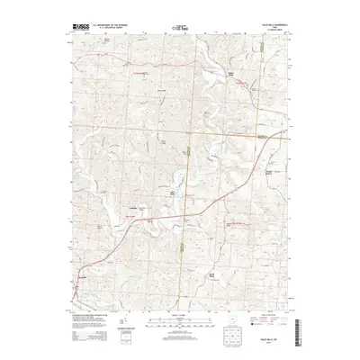
2013 Map of Vales Mills
USGS Topo · Published 2013About this map
Raccoon Creek and its many tributaries, including Elk Fork and Brush Fork, define the drainage patterns of this corner of Southeast Ohio where Vinton, Athens, and Meigs Counties meet. The landscape is marked by a legacy of milling and small-scale settlement, evidenced by places like Vales Mills and Bolins Mills. Local history is deeply embedded in the terrain at Eakin Mill Bridge and a network of family and community cemeteries such as Harkins Chapel Cem and Putnam Chapel Cem that dot the ridges. Prominent elevations like Union Ridge and Perry Ridge rise above the hollows, while the historic hamlet of Arbaugh and the crossroads at Radcliff show the distribution of rural life along the winding road network. The map reveals the persistence of these small communities and the topographical challenges that shaped their development through the early 21st century.
Find a feature on this map
99 named features on this map. Tap any name to fly to it.
Don’t see what you’re looking for? This feature index may not catch every label — zoom into the map to look around manually.
Map Details
Editions of this 2013 Vales Mills Map
This is the sole edition of this map. No revisions or reprints were ever made.
Other maps of this area

1903 · Athens
USGS Topo · 1:62,500

1904 · Zaleski
USGS Topo · 1:62,500

1905 · Athens
USGS Topo · 1:62,500

1905 · Wilkesville
USGS Topo · 1:62,500

1907 · Pomeroy
USGS Topo · 1:62,500

1907 · Zaleski
USGS Topo · 1:62,500

1908 · Wilkesville
USGS Topo · 1:62,500

1947 · Columbus
USGS Topo · 1:250,000

1960 · Albany
USGS Topo · 1:24,000

1960 · Rutland
USGS Topo · 1:24,000