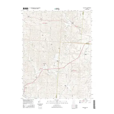
2016 Map of Vales Mills
USGS Topo · Published 2016About this map
Raccoon Creek winds through this section of the Vinton County hills, serving as a geographic anchor for the rural communities of Vales Mills and Bolins Mills. The landscape is defined by its deep hollows and high ridges, including Perry Ridge and Union Ridge, which shaped the early road network and settlement patterns. Numerous family and community burial grounds, such as Harkins Chapel Cem and Putnam Chapel Cem, are scattered throughout the hills, providing valuable data points for genealogical research in this part of Ohio.
Find a feature on this map
101 named features on this map. Tap any name to fly to it.
Don’t see what you’re looking for? This feature index may not catch every label — zoom into the map to look around manually.
Map Details
Editions of this 2016 Vales Mills Map
This is the sole edition of this map. No revisions or reprints were ever made.
Other maps of this area

1903 · Athens
USGS Topo · 1:62,500

1904 · Zaleski
USGS Topo · 1:62,500

1905 · Athens
USGS Topo · 1:62,500

1905 · Wilkesville
USGS Topo · 1:62,500

1907 · Pomeroy
USGS Topo · 1:62,500

1907 · Zaleski
USGS Topo · 1:62,500

1908 · Wilkesville
USGS Topo · 1:62,500

1947 · Columbus
USGS Topo · 1:250,000

1960 · Albany
USGS Topo · 1:24,000

1960 · Rutland
USGS Topo · 1:24,000