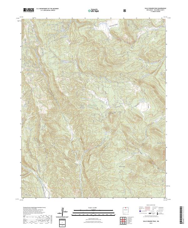
2023 Map of Valle Grande Peak
USGS Topo · Published 2023About this map
Valle Grande Peak dominates this high-country landscape within the Carson National Forest, where a network of seasonal drainages and springs defines the remote terrain. The presence of Ranchitos and the named Jarita Ranches suggests a long history of high-altitude livestock grazing, supported by specialized infrastructure like Chupa Rosas Tank and Los Gatos Tank. The intricate drainage system of Arroyo Seco and Cañon de la Madera flows through the Ortega Mountains, revealing how water access dictated land use in this part of Rio Arriba County.
Find a feature on this map
41 named features on this map. Tap any name to fly to it.
Don’t see what you’re looking for? This feature index may not catch every label — zoom into the map to look around manually.
Map Details
Editions of this 2023 Valle Grande Peak Map
This is the sole edition of this map. No revisions or reprints were ever made.
Other maps of this area

1918 · Abiquiu
USGS Topo · 1:125,000

1918 · Tusas
USGS Topo · 1:125,000

1953 · Valle Grande Peak
USGS Topo · 1:24,000

1953 · Magote Peak
USGS Topo · 1:24,000

1953 · El Rito
USGS Topo · 1:24,000

1953 · La Madera
USGS Topo · 1:24,000

1953 · Ojo Caliente
USGS Topo · 1:24,000

1953 · Canjilon SE
USGS Topo · 1:24,000

1954 · Aztec
USGS Topo · 1:250,000

1955 · Cebolla
USGS Topo · 1:62,500