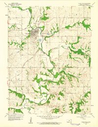
1959 Map of Valley Falls
USGS Topo · Published 1961About this map
Valley Falls serves as the central hub of this Jefferson County landscape, situated at a strategic bend where the Delaware River meets Walnut Creek. In the late 1950s, the town's geography is defined by the heavy presence of the Santa Fe, Atchison, and Topeka rail lines, which intersect near the river crossing. The surrounding townships of Delaware, Rock Creek, and Ozawkie consist of winding creek valleys and upland prairies dotted with local landmarks significant for genealogical research.
Find a feature on this map
27 named features on this map. Tap any name to fly to it.
Don’t see what you’re looking for? This feature index may not catch every label — zoom into the map to look around manually.
Map Details
Editions of this 1959 Valley Falls Map
2 editions found
Other maps of this area

1886 · Oskaloosa
USGS Topo · 1:125,000

1888 · Oskaloosa
USGS Topo · 1:125,000

1889 · Topeka
USGS Topo · 1:125,000

1894 · Oskaloosa
USGS Topo · 1:125,000

1894 · Topeka
USGS Topo · 1:125,000

1950 · Kansas City
USGS Topo · 1:250,000
1951 · Oskaloosa
USGS Topo · 1:24,000

1951 · Ozawkie
USGS Topo · 1:24,000
1952 · Meriden
USGS Topo · 1:24,000

1954 · Kansas City
USGS Topo · 1:250,000