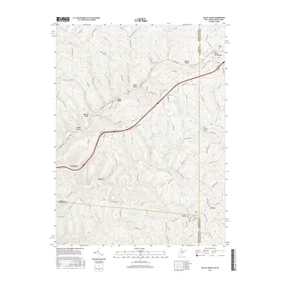
2016 Map of Valley Grove
USGS Topo · Published 2016About this map
The Erskine Covered Bridge spans Middle Wheeling Cr in this rural landscape straddling the West Virginia and Pennsylvania border. The area is defined by a dense network of springs and family-named landmarks, such as Louis Lasch Spring, John Kochy Spring, and Martin Berberich Spring, which speak to the deep agrarian roots of the community. In the more developed corridor along National Rd, the settlements of Valley Grove, Point Mills, and Triadelphia cluster near the headwaters of Little Wheeling Cr. Genealogists will find significant value in the mapped burial sites, including the West Allegheny Cem near West Alexander and the Mount View Cem at Dallas, providing a clear view of the region's established townships and long-standing family holdings during the mid-2010s.
Find a feature on this map
170 named features on this map. Tap any name to fly to it.
Don’t see what you’re looking for? This feature index may not catch every label — zoom into the map to look around manually.
Map Details
Editions of this 2016 Valley Grove Map
This is the sole edition of this map. No revisions or reprints were ever made.
Other maps of this area

1902 · Wheeling
USGS Topo · 1:62,500

1904 · Cameron
USGS Topo · 1:62,500

1905 · Rogersville
USGS Topo · 1:62,500

1907 · Claysville
USGS Topo · 1:62,500

1935 · Cameron
USGS Topo · 1:62,500

1935 · Wheeling
USGS Topo · 1:62,500

1942 · Cameron
USGS Topo · 1:62,500

1942 · Wheeling
USGS Topo · 1:62,500

1949 · Clarksburg
USGS Topo · 1:250,000

1951 · Canton
USGS Topo · 1:250,000