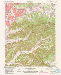
1982 Map of Valley Station
USGS Topo · Published 1991About this map
The suburban development of southwest Jefferson County is caught in a moment of rapid transition on this 1980s topographic record. Organized residential clusters like Valley Gardens, Valley Downs, and Prairie Village dominate the northwestern sector, showing the expansion of the Louisville metropolitan fringe into former farmland. This dense settlement pattern contrasts sharply with the south and east, where the terrain breaks into the wooded ridges of the Jefferson County Memorial Forest.
Find a feature on this map
12 named features on this map. Tap any name to fly to it.
Don’t see what you’re looking for? This feature index may not catch every label — zoom into the map to look around manually.
Map Details
Editions of this 1982 Valley Station Map
4 editions found
Other maps of this area

1907 · Louisville
USGS Topo · 1:62,500

1909 · Kosmosdale
USGS Topo · 1:48,000

1912 · Kosmosdale
USGS Topo · 1:62,500

1936 · Vine Grove
USGS Topo · 1:62,500

1943 · Vine Grove
USGS Topo · 1:62,500

1946 · Pitts Point
USGS Topo · 1:24,000

1946 · Fort Knox
USGS Topo · 1:24,000

1946 · Vine Grove
USGS Topo · 1:62,500

1949 · Shepherdsville
USGS Topo · 1:24,000

1949 · Shepherdsville
USGS Topo · 1:62,500