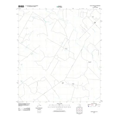
2010 Map of Valley Wells
USGS Topo · Published 2010About this map
The Nueces River winds through this South Texas landscape, defining a region where water management and ranching shape the terrain. At Valley Wells, the intersection of FM 1019 and FM 1558 serves as a local hub, while the presence of the Good Luck Oil Field to the north points to the area's energy industry. The map reveals a private aviation and ranching infrastructure centered around the Diamond H Ranch, which includes the Diamond H Ranch Airport and an extensive network of local roads like Diamond H Rd. Drainage across the quadrangle is managed by several significant water features, including Appurceon Creek and Sauz Mocho Creek. Human-made improvements are visible at Kone Lake Dam and Chip Briscoe Lake Dam, which regulate the flow of smaller tributaries in this arid environment. The layout of the Diamond H Ranch and its surrounding county roads reflects the large-scale landholdings typical of this portion of Dimmit County.
Find a feature on this map
18 named features on this map. Tap any name to fly to it.
Don’t see what you’re looking for? This feature index may not catch every label — zoom into the map to look around manually.
Map Details
Editions of this 2010 Valley Wells Map
This is the sole edition of this map. No revisions or reprints were ever made.
Other maps of this area

1925 · San Roque Lake 1-a
USGS Topo · 1:48,000

1927 · Bart
USGS Topo · 1:62,500

1929 · Cotulla
USGS Topo · 1:125,000

1932 · Valley Wells
USGS Topo · 1:62,500

1939 · Big Wells
USGS Topo · 1:62,500

1940 · Catarina
USGS Topo · 1:62,500

1940 · Artesia Wells
USGS Topo · 1:62,500

1953 · Crystal City
USGS Topo · 1:250,000

1955 · Crystal City
USGS Topo · 1:250,000

1956 · Woodward
USGS Topo · 1:62,500