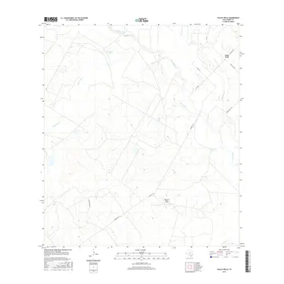
2016 Map of Valley Wells
USGS Topo · Published 2016About this map
The Nueces River winds through this section of Dimmit County, shaping a landscape defined by ranching and water management. Near the settlement of Valley Wells, the terrain is marked by a network of drainage systems including Appurceon Cr, Sauz Mocho Cr, and San Roque Cr. Large ranching operations are evident through named infrastructure such as the Diamond H Ranch Airport and its associated Diamond H Rch Rd. The presence of scattered water bodies like Buckhorn Lake, Kone Lake, and Chip Briscoe Lake illustrates the importance of water catchment in this South Texas environment, where ranch roads like Federico Rd and Henrichson Co Rd provide the primary links between isolated properties and the regional route of FM 1019.
Find a feature on this map
17 named features on this map. Tap any name to fly to it.
Don’t see what you’re looking for? This feature index may not catch every label — zoom into the map to look around manually.
Map Details
Editions of this 2016 Valley Wells Map
This is the sole edition of this map. No revisions or reprints were ever made.
Other maps of this area

1925 · San Roque Lake 1-a
USGS Topo · 1:48,000

1927 · Bart
USGS Topo · 1:62,500

1929 · Cotulla
USGS Topo · 1:125,000

1932 · Valley Wells
USGS Topo · 1:62,500

1939 · Big Wells
USGS Topo · 1:62,500

1940 · Catarina
USGS Topo · 1:62,500

1940 · Artesia Wells
USGS Topo · 1:62,500

1953 · Crystal City
USGS Topo · 1:250,000

1955 · Crystal City
USGS Topo · 1:250,000

1956 · Woodward
USGS Topo · 1:62,500