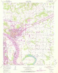
1947 Map of Van Buren
USGS Topo · Published 1978About this map
Van Buren serves as a critical industrial and transit hub along the Arkansas River in this mid-century survey, updated to reflect the expansion of the late 1970s. The landscape is defined by the convergence of the St Louis-San Francisco and Missouri Pacific railroads, which supported local industry like the Zinc smelter and various strip mines scattered across the eastern plains. The mapping reveals a detailed social fabric of the era, marked by numerous small rural churches like Sunnyside Church and New Hope Church, alongside established family and community burial grounds including Grace Lawn Cemetery and Gills Cemetery. Near the river, the Twin City Airport and Byrns Bridge provide evidence of the region's evolving transportation infrastructure as it transitioned from a rail-dominated economy toward increased highway and air connectivity.
Find a feature on this map
49 named features on this map. Tap any name to fly to it.
Don’t see what you’re looking for? This feature index may not catch every label — zoom into the map to look around manually.
Map Details
Editions of this 1947 Van Buren Map
3 editions found
Other maps of this area

1879 · Fort Smith
USGS Topo · 1:62,500

1887 · Van Buren
USGS Topo · 1:62,500

1890 · Fort Smith
USGS Topo · 1:125,000

1898 · Winslow #4
USGS Topo · 1:62,500

1898 · Winslow #3
USGS Topo · 1:62,500

1898 · Winslow
USGS Topo · 1:125,000

1901 · Winslow
USGS Topo · 1:125,000

1906 · Lavaca
USGS Topo · 1:62,500

1943 · Fort Smith
USGS Topo · 1:125,000

1946 · Fort Smith
USGS Topo · 1:250,000