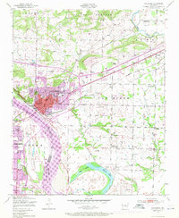
1947 Map of Van Buren
USGS Topo · Published 1971About this map
The Arkansas River serves as the focal point for this post-war landscape, carving a wide path through the river valley south of Van Buren. Extensive purple overprinting from 1971 updates reveals the mid-century expansion of the city's residential and commercial footprint, which surrounds the older street grid and Fairview Cemetery. Industrial activity is evident along the Missouri Pacific and St Louis-San Francisco rail lines, including a large Zinc smelter and several active and abandoned strip mines in the outlying rural districts of Van Buren township.
Find a feature on this map
45 named features on this map. Tap any name to fly to it.
Don’t see what you’re looking for? This feature index may not catch every label — zoom into the map to look around manually.
Map Details
Editions of this 1947 Van Buren Map
3 editions found
Other maps of this area

1879 · Fort Smith
USGS Topo · 1:62,500

1887 · Van Buren
USGS Topo · 1:62,500

1890 · Fort Smith
USGS Topo · 1:125,000

1898 · Winslow #4
USGS Topo · 1:62,500

1898 · Winslow #3
USGS Topo · 1:62,500

1898 · Winslow
USGS Topo · 1:125,000

1901 · Winslow
USGS Topo · 1:125,000

1906 · Lavaca
USGS Topo · 1:62,500

1943 · Fort Smith
USGS Topo · 1:125,000

1946 · Fort Smith
USGS Topo · 1:250,000