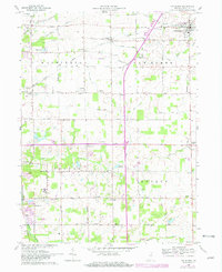
1962 Map of Van Buren
USGS Topo · Published 1982About this map
Van Buren serves as the primary hub of activity in this northeastern Grant County landscape, situated amidst a grid of agricultural land and managed waterways. Small rural centers like Landess and Hanfield punctuate the township lines, revealing a settlement pattern deeply tied to local rural life. The landscape is defined by an extensive network of drainage features such as Buck Run and Brushy Run, along with man-made interventions like the Ludlum Ditch and Goff Ditch, which support the region's productive farm acreage.
Find a feature on this map
47 named features on this map. Tap any name to fly to it.
Don’t see what you’re looking for? This feature index may not catch every label — zoom into the map to look around manually.
Map Details
Editions of this 1962 Van Buren Map
2 editions found
Other maps of this area

1950 · Warren
USGS Topo · 1:24,000

1950 · Mount Etna
USGS Topo · 1:24,000

1951 · Mount Etna
USGS Topo · 1:24,000

1952 · Warren
USGS Topo · 1:24,000

1953 · La Fontaine
USGS Topo · 1:24,000

1953 · Muncie
USGS Topo · 1:250,000

1956 · Muncie
USGS Topo · 1:250,000

1960 · Fairmount
USGS Topo · 1:24,000

1960 · Gas City
USGS Topo · 1:24,000

1960 · Hartford City West
USGS Topo · 1:24,000