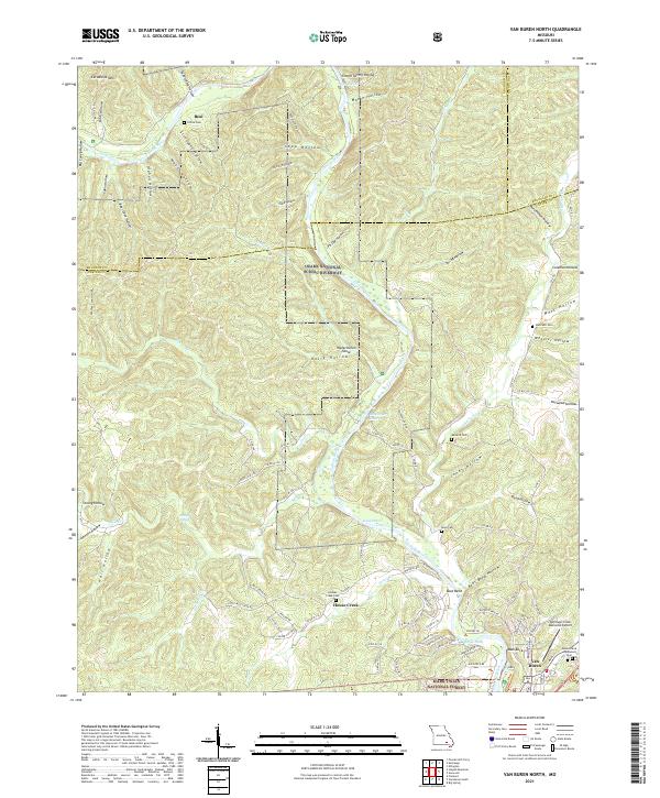
2021 Map of Van Buren North
USGS Topo · Published 2021About this map
The Current River winds through this section of the Ozarks, carving a path through a landscape defined by deep hollows and high points like Cardareva Mtn. This area is preserved within the Ozark National Scenic Riverways and the Mark Twain National Forest, illustrating a region where public conservation efforts overlap with small-scale private settlements. The river is the central corridor for both geography and local nomenclature, featuring named points such as Watermelon Shoal, Shote Hole, and Quiet Pool.
Find a feature on this map
102 named features on this map. Tap any name to fly to it.
Don’t see what you’re looking for? This feature index may not catch every label — zoom into the map to look around manually.
Map Details
Editions of this 2021 Van Buren North Map
This is the sole edition of this map. No revisions or reprints were ever made.
Other maps of this area

1928 · Cardareva
USGS Topo · 1:62,500

1943 · Ellington
USGS Topo · 1:62,500

1944 · Van Buren
USGS Topo · 1:62,500

1944 · Grandin
USGS Topo · 1:62,500

1945 · Ellington
USGS Topo · 1:62,500

1946 · Grandin
USGS Topo · 1:62,500

1946 · Van Buren
USGS Topo · 1:62,500

1949 · Rolla
USGS Topo · 1:250,000

1949 · Cardareva
USGS Topo · 1:62,500

1953 · Rolla
USGS Topo · 1:250,000