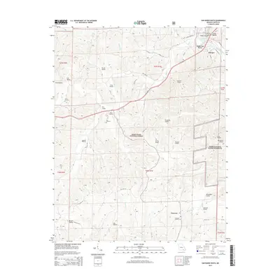
2015 Map of Van Buren South
USGS Topo · Published 2015About this map
The Current River winds through the northeastern corner of this region, shaping the development of Van Buren and its neighboring communities of South Van Buren and Chicopee. This 2015 landscape is defined by the deep dissection of the Ozark Plateau, where dozens of named hollows like Walker Hollow and Poca Hollow drain toward the river system. Large portions of the territory are managed as the Mark Twain National Forest and the Ozark National Scenic Riverways, reflecting a modern era of conservation and recreation along these historic waterways. Further south, the settlement of Eastwood sits near Eastwood Cemetery, connected by a network of forest roads and county routes. The map provides a detailed view of the terrain's transition from river valley to the timbered ridges, preserving the location of family-named landmarks such as Turley Cemetery and unique geographic features like the Tie Broom Stretch.
Find a feature on this map
55 named features on this map. Tap any name to fly to it.
Don’t see what you’re looking for? This feature index may not catch every label — zoom into the map to look around manually.
Map Details
Editions of this 2015 Van Buren South Map
This is the sole edition of this map. No revisions or reprints were ever made.
Other maps of this area

1928 · Cardareva
USGS Topo · 1:62,500

1943 · Ellington
USGS Topo · 1:62,500

1944 · Van Buren
USGS Topo · 1:62,500

1944 · Grandin
USGS Topo · 1:62,500

1945 · Ellington
USGS Topo · 1:62,500

1946 · Grandin
USGS Topo · 1:62,500

1946 · Van Buren
USGS Topo · 1:62,500

1949 · Rolla
USGS Topo · 1:250,000

1949 · Cardareva
USGS Topo · 1:62,500

1953 · Rolla
USGS Topo · 1:250,000