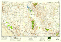
1958 Map of Van Horn
USGS Topo · Published 1958About this map
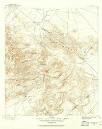
The high desert basins and peaks of the Trans-Pecos dominate this late 1950s survey, anchoring the intersection of the Texas and Pacific and Southern Pacific railroads. The town of Van Horn serves as a critical junction, situated between the Beach Mountains and the Wylie Mountains, while Sierra Blanca marks the western gateway where these major rail lines converge near the Quitman Mountains. This landscape is defined by its isolation and the necessity of water, evidenced by the sprawling Crow Flats and the numerous family holdings such as Patterson Ranch and Mayfield Ranch that dot the arid terrain.
Find a feature on this map
107 named features on this map. Tap any name to fly to it.
Don’t see what you’re looking for? This feature index may not catch every label — zoom into the map to look around manually.
Map Details
Editions of this 1958 Van Horn Map
This is the sole edition of this map. No revisions or reprints were ever made.
Other maps of this area
1892 · Chispa
USGS Topo · 1:125,000
1894 · Fort Hancock
USGS Topo · 1:125,000
1894 · Valentine
USGS Topo · 1:125,000
1894 · Fort Davis
USGS Topo · 1:125,000
1895 · Chispa
USGS Topo · 1:125,000
1895 · Sierra Blanca
USGS Topo · 1:125,000
1896 · El Paso
USGS Topo · 1:125,000
1896 · Rio Grande
USGS Topo · 1:125,000
1897 · Valentine
USGS Topo · 1:125,000
1897 · Fort Davis
USGS Topo · 1:125,000