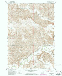
1951 Map of Van Metre
USGS Topo · Published 1987About this map
Van Metre sits at the heart of this South Dakota landscape, positioned where the Chicago and North Western railroad tracks parallel the winding course of the Bad River. The terrain is defined by the sharp, dissected breaks of the river valley, where seasonal drainages like Plum Creek and Dry Creek carve through the prairie. This 1951 field-checked survey, updated in the 1980s, reveals a remote ranching and transit landscape at the border of Stanley Co and Jones Co. The proximity of the rail line to the river suggests the importance of water access and transport infrastructure in this section of the Missouri River Basin development area. While the settlement at Van Metre remains small, its role as a named station along the railroad highlights its historical significance as a shipping point for the surrounding cattle country.
Find a feature on this map
6 named features on this map. Tap any name to fly to it.
Don’t see what you’re looking for? This feature index may not catch every label — zoom into the map to look around manually.
Map Details
Editions of this 1951 Van Metre Map
3 editions found
Other maps of this area

1937 · Oahe
USGS Topo · 1:62,500

1951 · Capa
USGS Topo · 1:24,000

1951 · Van Metre
USGS Topo · 1:24,000

1951 · Capa NW
USGS Topo · 1:24,000

1951 · Capa SE
USGS Topo · 1:24,000

1953 · Oahe SW
USGS Topo · 1:24,000

1953 · Wendte
USGS Topo · 1:24,000

1954 · Pierre
USGS Topo · 1:250,000

1958 · Pierre
USGS Topo · 1:250,000
1972 · Wendte SW
USGS Topo · 1:24,000