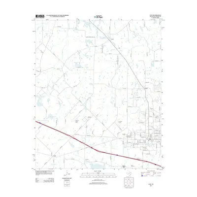
2012 Map of Van
USGS Topo · Published 2012About this map
The town of Van anchors this East Texas landscape, showing a dense residential grid transitioning into the surrounding countryside of Van Zandt County. A legacy of energy production is evident in the Van Oil Field to the northeast, while the southern border is defined by the course of the Neches River near Colfax. The area is dotted with numerous small water bodies, including Rhine Lake, Poco Lake, and the three Metzger Lakes, reflecting the region's complex drainage through Little Saline Creek and Glade Branch. Genealogy researchers will find several local burial grounds, such as Pace Cemetery near Jones and Marvin Chapel Cemetery further south. Aviation and leisure are represented by the Wits End Ranch Airport, N D Ranch Airport, and the Poco Golf Course, which serve the small communities of Pruitt and Clower as they connect via a network of farm-to-market roads and the prominent path of FM-16.
Find a feature on this map
56 named features on this map. Tap any name to fly to it.
Don’t see what you’re looking for? This feature index may not catch every label — zoom into the map to look around manually.
Map Details
Editions of this 2012 Van Map
This is the sole edition of this map. No revisions or reprints were ever made.
Other maps of this area

1948 · Brownsboro
USGS Topo · 1:62,500

1948 · Martins Mill
USGS Topo · 1:62,500

1949 · Martins Mill
USGS Topo · 1:62,500

1949 · Brownsboro
USGS Topo · 1:62,500

1956 · Tyler
USGS Topo · 1:250,000

1959 · Golden
USGS Topo · 1:24,000

1959 · Grand Saline
USGS Topo · 1:24,000

1959 · Van
USGS Topo · 1:24,000

1959 · Van Lake
USGS Topo · 1:24,000

1959 · Grand Saline
USGS Topo · 1:62,500