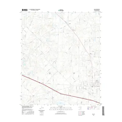
2016 Map of Van
USGS Topo · Published 2016About this map
Van stands as the primary hub in this East Texas landscape, where the modern corridor of the I-20 Service Road cuts across a region defined by its creek systems and small rural communities. The map highlights the headwaters of the Neches River, which flows south from Rhine Lake, while Big Sandy Creek and Koonce Creek drain the northern reaches. For local historians and genealogists, the survey identifies several key burial grounds including Jones Community Cemetery and Marvin Chapel Cemetery, which anchor the smaller settlements of Jones and Colfax. The terrain is characterized by a series of impoundments like Metzger Lake Number 3 and Poco Lake, reflecting the local water management and agricultural needs of the mid-2010s. Private aviation is also represented by the Wits End Ranch Airport and N D Ranch Airport, tucked away between the county's winding backroads.
Find a feature on this map
111 named features on this map. Tap any name to fly to it.
Don’t see what you’re looking for? This feature index may not catch every label — zoom into the map to look around manually.
Map Details
Editions of this 2016 Van Map
This is the sole edition of this map. No revisions or reprints were ever made.
Other maps of this area

1948 · Brownsboro
USGS Topo · 1:62,500

1948 · Martins Mill
USGS Topo · 1:62,500

1949 · Martins Mill
USGS Topo · 1:62,500

1949 · Brownsboro
USGS Topo · 1:62,500

1956 · Tyler
USGS Topo · 1:250,000

1959 · Golden
USGS Topo · 1:24,000

1959 · Grand Saline
USGS Topo · 1:24,000

1959 · Van
USGS Topo · 1:24,000

1959 · Van Lake
USGS Topo · 1:24,000

1959 · Grand Saline
USGS Topo · 1:62,500