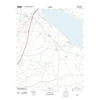
2011 Map of Vance
USGS Topo · Published 2011About this map
Lake Marion dominates the northern landscape of this region, where the reservoir waters meet a complex network of wetlands and tributaries. The settlement of Santee serves as a gateway to the lake, while further south, the town of Vance and the locality of Bull Station mark the inland transitions toward the Lowcountry interior. This 2011 survey reveals a landscape defined by its hydrology, where the large expanse of the lake is fed and bordered by features like Horse Range Swamp and Webbs Creek. Genealogists will find significant local data points in the numerous family and community burial grounds, such as Bell Cemetery, Dantzler-Hart Cemetery, and Liberty Hill Cemetery. The infrastructure of the era is represented by the Santee Golf Air Strip and local landmarks like Bob Marina, showing how the area developed into a hub for both aviation and recreational water access.
Find a feature on this map
136 named features on this map. Tap any name to fly to it.
Don’t see what you’re looking for? This feature index may not catch every label — zoom into the map to look around manually.
Map Details
Editions of this 2011 Vance Map
This is the sole edition of this map. No revisions or reprints were ever made.
Other maps of this area

1920 · Eutawville
USGS Topo · 1:48,000

1920 · Bowman
USGS Topo · 1:48,000

1921 · Bowman
USGS Topo · 1:62,500

1921 · Eutawville
USGS Topo · 1:62,500

1943 · Bowman
USGS Topo · 1:62,500

1943 · Orangeburg
USGS Topo · 1:125,000

1943 · Eutawville
USGS Topo · 1:62,500

1946 · Elloree
USGS Topo · 1:62,500

1954 · Augusta
USGS Topo · 1:250,000

1957 · Augusta
USGS Topo · 1:250,000