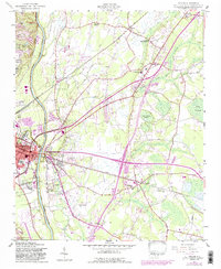
1957 Map of Vander
USGS Topo · Published 1987About this map
The Cape Fear River dominates the western edge of this landscape, serving as a historic boundary and navigation artery for Fayetteville. In the late 1950s, the area east of the river shows a transition from the urban density of East Fayetteville and Williams Village to the wetlands and agricultural tracts around Vander. The map highlights a significant ecclesiastical footprint with numerous country churches like Lebanon Missionary Ch and Flat Swamp Ch, reflecting the deep-rooted community structure of Cumberland County.
Find a feature on this map
46 named features on this map. Tap any name to fly to it.
Don’t see what you’re looking for? This feature index may not catch every label — zoom into the map to look around manually.
Map Details
Editions of this 1957 Vander Map
4 editions found

Other maps of this area

1948 · Fayetteville
USGS Topo · 1:62,500

1948 · Slocomb
USGS Topo · 1:24,000

1949 · Vander
USGS Topo · 1:24,000

1950 · Fayetteville
USGS Topo · 1:24,000

1950 · Manchester
USGS Topo · 1:24,000

1950 · Slocomb
USGS Topo · 1:24,000

1953 · Florence
USGS Topo · 1:250,000

1953 · Raleigh
USGS Topo · 1:250,000

1954 · Florence
USGS Topo · 1:250,000

1954 · Raleigh
USGS Topo · 1:250,000