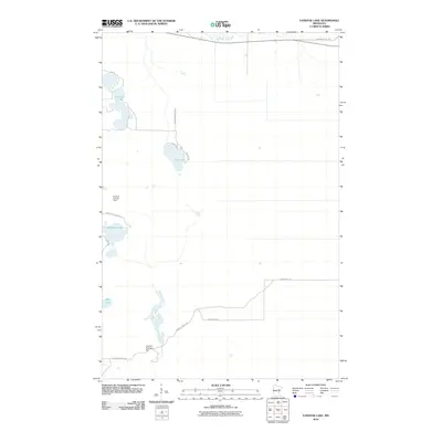
2010 Map of Vanduse Lake
USGS Topo · Published 2010About this map
Savanna State Frst occupies a significant portion of this northern landscape, dominated by a complex network of wetlands and glacial lakes. Centrally located on the western edge, the Ball Bluff Lookout Tower stands as a landmark for forest observation, connected by the winding Ball Bluff Tower Rd. To the south, the Cornish Flowage is controlled by the Cornish Flowage Dam, representing the water management infrastructure essential to this region. The northern boundary is defined by the meandering Swan River, while internal access is maintained through routes such as Floodwood Rd and Hedbom Forest Trl. This map illustrates the intersection of state-managed forest land and the natural hydrology of Aitkin County, from the shores of Vanduse Lake and Hay Lake to the protected forest interior.
Find a feature on this map
16 named features on this map. Tap any name to fly to it.
Don’t see what you’re looking for? This feature index may not catch every label — zoom into the map to look around manually.
Map Details
Editions of this 2010 Vanduse Lake Map
This is the sole edition of this map. No revisions or reprints were ever made.
Other maps of this area

1953 · Duluth
USGS Topo · 1:250,000

1954 · Hibbing
USGS Topo · 1:250,000

1957 · Hibbing
USGS Topo · 1:250,000

1958 · Hibbing
USGS Topo · 1:250,000

1958 · Duluth
USGS Topo · 1:250,000

1964 · Hibbing
USGS Topo · 1:250,000

1969 · Wawina
USGS Topo · 1:24,000

1969 · Island
USGS Topo · 1:24,000

1970 · Little Prairie Lake
USGS Topo · 1:24,000
1970 · Swan River
USGS Topo · 1:24,000