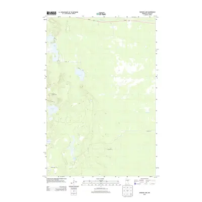
2013 Map of Vanduse Lake
USGS Topo · Published 2013About this map
Ball Bluff Lookout Tower stands as a prominent sentinel over this pocket of Aitkin County, situated atop the elevation of Ball Bluff. The landscape is defined by its complex hydrology, where the Swan River flows across the northern reaches and numerous smaller bodies of water like Vanduse Lake, Hay Lake, and Blackface Lake are distributed through the glacial terrain.
Find a feature on this map
17 named features on this map. Tap any name to fly to it.
Don’t see what you’re looking for? This feature index may not catch every label — zoom into the map to look around manually.
Map Details
Editions of this 2013 Vanduse Lake Map
This is the sole edition of this map. No revisions or reprints were ever made.
Other maps of this area

1953 · Duluth
USGS Topo · 1:250,000

1954 · Hibbing
USGS Topo · 1:250,000

1957 · Hibbing
USGS Topo · 1:250,000

1958 · Hibbing
USGS Topo · 1:250,000

1958 · Duluth
USGS Topo · 1:250,000

1964 · Hibbing
USGS Topo · 1:250,000

1969 · Wawina
USGS Topo · 1:24,000

1969 · Island
USGS Topo · 1:24,000

1970 · Little Prairie Lake
USGS Topo · 1:24,000
1970 · Swan River
USGS Topo · 1:24,000