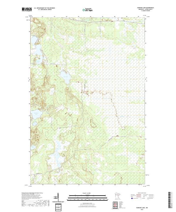
2022 Map of Vanduse Lake
USGS Topo · Published 2022About this map
Vanduse Lake and its surrounding wetlands dominate this Aitkin County landscape, characterized by a complex network of glacial basins and watercourses. Small-scale residential development is concentrated along the western shores, evidenced by local routes like Edblad Shore Rd and 667th Ln. To the south, Blackface Lake and Bay Lake sit amidst a heavy concentration of marshland, suggesting a region largely defined by its natural hydrology rather than intensive agriculture or industry. The interior is crossed by the Hedbom Forest Trl, which winds through the southern townships, while the drainage of Sixteen Cr moves through the eastern sections. This survey provides a clear view of the modern balance between private shoreline property and the vast, undeveloped wetland systems of north-central Minnesota.
Find a feature on this map
23 named features on this map. Tap any name to fly to it.
Don’t see what you’re looking for? This feature index may not catch every label — zoom into the map to look around manually.
Map Details
Editions of this 2022 Vanduse Lake Map
This is the sole edition of this map. No revisions or reprints were ever made.
Other maps of this area

1953 · Duluth
USGS Topo · 1:250,000

1954 · Hibbing
USGS Topo · 1:250,000

1957 · Hibbing
USGS Topo · 1:250,000

1958 · Hibbing
USGS Topo · 1:250,000

1958 · Duluth
USGS Topo · 1:250,000

1964 · Hibbing
USGS Topo · 1:250,000

1969 · Wawina
USGS Topo · 1:24,000

1969 · Island
USGS Topo · 1:24,000

1970 · Little Prairie Lake
USGS Topo · 1:24,000
1970 · Swan River
USGS Topo · 1:24,000