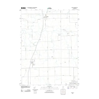
2012 Map of Varna
USGS Topo · Published 2012About this map
Varna serves as a central hub for this portion of Marshall County, situated where regional roads converge amidst a landscape deeply shaped by drainage basins like Gaylords Br and Myers Cr. The map reveals a high concentration of burial sites, including the Magnolia Cem, Salem Cem, and Cumberland Cem, which offer significant value for genealogical research. A notable historical transport link is preserved in the naming of Old Stage Coach Rd, providing a hint of the area's pre-highway travel patterns. The northern boundary is defined by the village of Magnolia, while the southern edge touches the outskirts of Toluca. Smaller named locales such as Porterfield and Custer appear alongside specialized infrastructure like the Junker Landing Strip, illustrating the mix of traditional agriculture and modern utility in this Illinois prairie region.
Find a feature on this map
73 named features on this map. Tap any name to fly to it.
Don’t see what you’re looking for? This feature index may not catch every label — zoom into the map to look around manually.
Map Details
Editions of this 2012 Varna Map
This is the sole edition of this map. No revisions or reprints were ever made.
Other maps of this area

1893 · Lacon
USGS Topo · 1:62,500

1893 · Metamora
USGS Topo · 1:62,500

1933 · Lacon
USGS Topo · 1:62,500

1934 · Wenona
USGS Topo · 1:48,000

1937 · Metamora
USGS Topo · 1:62,500

1937 · Lacon
USGS Topo · 1:62,500

1939 · Wenona
USGS Topo · 1:62,500

1948 · Metamora
USGS Topo · 1:62,500

1955 · Minonk
USGS Topo · 1:62,500

1958 · Aurora
USGS Topo · 1:250,000