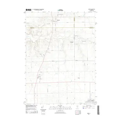
2015 Map of Varna
USGS Topo · Published 2015About this map
Magnolia and Varna anchor this 2015 survey of the Illinois prairie where Putnam, LaSalle, and Marshall Counties meet. The landscape is defined by a dense grid of rural roads and the dendritic drainage patterns of Sandy Creek and its tributaries, including Judd Creek and Gaylords Br. Genealogists will find a cluster of well-preserved burial sites across the township lines, such as Magnolia Cem and Cumberland Cem, while the historic Stage Coach Rd provides a link to earlier transit routes. The southern edge of the map reaches the periphery of Toluca, showing the transition from small agricultural hubs like Custer and Porterfield to larger residential settlements. The detailed topography illustrates how watercourses like Roberts Br and N Br Crow Cr shaped the local farm layouts and property boundaries over generations.
Find a feature on this map
71 named features on this map. Tap any name to fly to it.
Don’t see what you’re looking for? This feature index may not catch every label — zoom into the map to look around manually.
Map Details
Editions of this 2015 Varna Map
This is the sole edition of this map. No revisions or reprints were ever made.
Other maps of this area

1893 · Lacon
USGS Topo · 1:62,500

1893 · Metamora
USGS Topo · 1:62,500

1933 · Lacon
USGS Topo · 1:62,500

1934 · Wenona
USGS Topo · 1:48,000

1937 · Metamora
USGS Topo · 1:62,500

1937 · Lacon
USGS Topo · 1:62,500

1939 · Wenona
USGS Topo · 1:62,500

1948 · Metamora
USGS Topo · 1:62,500

1955 · Minonk
USGS Topo · 1:62,500

1958 · Aurora
USGS Topo · 1:250,000