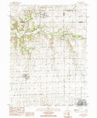
1983 Map of Varna
USGS Topo · Published 1984About this map
Varna and the surrounding agricultural townships of Magnolia, Roberts, and Evans anchor this northern Illinois landscape during the early 1980s. The region is defined by a dense network of local heritage sites, including numerous rural burial grounds such as Statler Cem, Salem Cem, and Roberts Cem, which serve as vital markers for genealogical research. The transition of the local economy is evidenced by the prominent Old Railroad Grade and Old Grade RR segments that bypass the center of Varna, indicating the shifting transportation patterns that once connected these prairie settlements.
Find a feature on this map
29 named features on this map. Tap any name to fly to it.
Don’t see what you’re looking for? This feature index may not catch every label — zoom into the map to look around manually.
Map Details
Editions of this 1983 Varna Map
This is the sole edition of this map. No revisions or reprints were ever made.
Other maps of this area

1893 · Lacon
USGS Topo · 1:62,500

1893 · Metamora
USGS Topo · 1:62,500

1933 · Lacon
USGS Topo · 1:62,500

1934 · Wenona
USGS Topo · 1:48,000

1937 · Metamora
USGS Topo · 1:62,500

1937 · Lacon
USGS Topo · 1:62,500

1939 · Wenona
USGS Topo · 1:62,500

1948 · Metamora
USGS Topo · 1:62,500

1955 · Minonk
USGS Topo · 1:62,500

1958 · Aurora
USGS Topo · 1:250,000