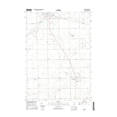
2014 Map of Vassar
USGS Topo · Published 2014About this map
The Cass River winds through the northern reach of this Tuscola County landscape, anchoring the settlement of Vassar. This region is characterized by a dense network of local drainages, including Millington Cr, Goodings Cr, and Perry Cr, which define the low-lying terrain and agricultural sections. The distribution of small airfields such as Vassar Field Airport and Jensen Field Airport reflects the rural transportation infrastructure of the early 21st century. Genealogists will find significant value in the placement of numerous burial grounds across the township lines, including Riverside Cem near the river, and Fuller Cem and Kilbourn Cem further east. The map captures the intersection of traditional township roads with the more modern Industrial Dr and the commercial center of Vassar, providing a detailed look at the land use patterns in this part of Michigan.
Find a feature on this map
75 named features on this map. Tap any name to fly to it.
Don’t see what you’re looking for? This feature index may not catch every label — zoom into the map to look around manually.
Map Details
Editions of this 2014 Vassar Map
This is the sole edition of this map. No revisions or reprints were ever made.
Other maps of this area

1920 · Flint
USGS Topo · 1:62,500

1922 · Flint
USGS Topo · 1:62,500

1943 · Flint
USGS Topo · 1:62,500

1954 · Flint
USGS Topo · 1:250,000

1958 · Flint
USGS Topo · 1:250,000

1963 · Reese
USGS Topo · 1:24,000

1963 · Columbiaville
USGS Topo · 1:24,000

1963 · Gilford
USGS Topo · 1:24,000

1963 · Caro
USGS Topo · 1:24,000

1963 · Frankenmuth
USGS Topo · 1:24,000