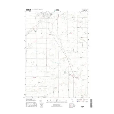
2017 Map of Vassar
USGS Topo · Published 2017About this map
The Cass River winds through the northern reach of this Tuscola County landscape, anchoring the city of Vassar. This mid-2010s survey reveals a well-defined grid of agricultural land and small-town residential development, where the northern hub of Vassar and the southern village of Millington serve as the primary population centers. Significant local history can be traced through the placement of several burial grounds, including Riverside Cem, Fuller Cem, and Kilbourn Cem, which are situated along the secondary roads that crisscross the terrain. Small aviation facilities like Vassar Field and Jensen Field underscore the rural infrastructure, while various waterways such as Goodings Cr, Millington Cr, and Perry Cr drain the fields and woodlands between the two municipalities.
Find a feature on this map
79 named features on this map. Tap any name to fly to it.
Don’t see what you’re looking for? This feature index may not catch every label — zoom into the map to look around manually.
Map Details
Editions of this 2017 Vassar Map
This is the sole edition of this map. No revisions or reprints were ever made.
Other maps of this area

1920 · Flint
USGS Topo · 1:62,500

1922 · Flint
USGS Topo · 1:62,500

1943 · Flint
USGS Topo · 1:62,500

1954 · Flint
USGS Topo · 1:250,000

1958 · Flint
USGS Topo · 1:250,000

1963 · Reese
USGS Topo · 1:24,000

1963 · Columbiaville
USGS Topo · 1:24,000

1963 · Gilford
USGS Topo · 1:24,000

1963 · Caro
USGS Topo · 1:24,000

1963 · Frankenmuth
USGS Topo · 1:24,000