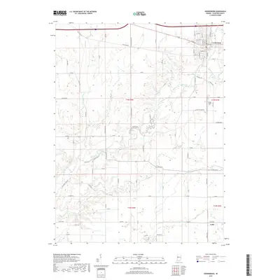
2019 Map of Veedersburg
USGS Topo · Published 2019About this map
Veedersburg sits at the junction of several regional routes and the winding Coal Creek, serving as the primary hub for this portion of Fountain County. The town's grid is well-defined by streets such as Indiana Ave and N Main St, reflecting its growth as a local center for commerce and residence. To the southeast, the small settlement of Yeddo remains a distinct point on the map, connected to the wider area by rural corridors like S Meridian Rd.
Find a feature on this map
82 named features on this map. Tap any name to fly to it.
Don’t see what you’re looking for? This feature index may not catch every label — zoom into the map to look around manually.
Map Details
Editions of this 2019 Veedersburg Map
This is the sole edition of this map. No revisions or reprints were ever made.
Other maps of this area

1948 · Wallace
USGS Topo · 1:24,000

1953 · Danville
USGS Topo · 1:250,000

1953 · Indianapolis
USGS Topo · 1:250,000

1955 · Danville
USGS Topo · 1:250,000

1955 · Kingman
USGS Topo · 1:24,000
1955 · Newport
USGS Topo · 1:24,000

1956 · Danville
USGS Topo · 1:250,000

1956 · Indianapolis
USGS Topo · 1:250,000

1957 · Indianapolis
USGS Topo · 1:250,000

1958 · Stonebluff
USGS Topo · 1:24,000