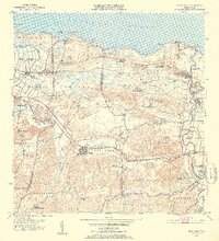
1953 Map of Vega Alta
USGS Topo · Published 1954About this map
Sugar production and coastal development define the landscape of northern Puerto Rico in this mid-century survey. The town of Vega Alta serves as a central hub, while the Central Constancia mill near Toa Baja highlights the enduring importance of the sugar industry to the local economy. Coastal settlements like Poblado Cerro Gordo and Parcelas Mameyal are connected by a network of roads and the tracks of the American RR, which skirts the wetlands of Ciénaga Sabana.
Find a feature on this map
81 named features on this map. Tap any name to fly to it.
Don’t see what you’re looking for? This feature index may not catch every label — zoom into the map to look around manually.
Map Details
Editions of this 1953 Vega Alta Map
2 editions found
Other maps of this area

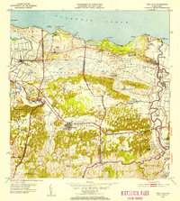
1940 · Vega Alta
USGS Topo · 1:30,000

1941 · Bayamon
USGS Topo · 1:30,000

1942 · Manati
USGS Topo · 1:30,000

1946 · Corozal
USGS Topo · 1:30,000

1946 · Ciales
USGS Topo · 1:30,000

1946 · Vega Alta
USGS Topo · 1:30,000

1946 · Naranjito
USGS Topo · 1:30,000

1946 · Manati
USGS Topo · 1:30,000

1947 · Corozal NO
USGS Topo · 1:10,000
1947 · Corozal NE
USGS Topo · 1:10,000