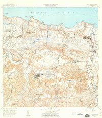
1958 Map of Vega Alta
USGS Topo · Published 1960About this map
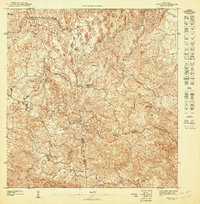
Coastal sugar production and early industrial development define this north shore landscape during the mid-century. The Central San Vicente sugar mill and the Central Constancia near Dorado highlight the agricultural economy, while the Ferrocarril Antigua Via traces the historical rail infrastructure used to transport cane and goods between settlements like Vega Alta and Toa Baja.
Find a feature on this map
82 named features on this map. Tap any name to fly to it.
Don’t see what you’re looking for? This feature index may not catch every label — zoom into the map to look around manually.
Map Details
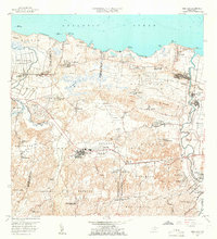
Editions of this 1958 Vega Alta Map
2 editions found
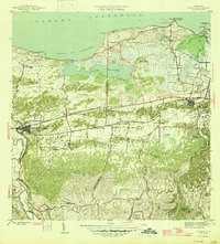
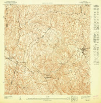
Other maps of this area

1940 · Vega Alta
USGS Topo · 1:30,000

1941 · Bayamon
USGS Topo · 1:30,000

1942 · Manati
USGS Topo · 1:30,000

1946 · Corozal
USGS Topo · 1:30,000

1946 · Ciales
USGS Topo · 1:30,000

1946 · Vega Alta
USGS Topo · 1:30,000

1946 · Naranjito
USGS Topo · 1:30,000
1946 · Manati
USGS Topo · 1:30,000
1947 · Corozal NO
USGS Topo · 1:10,000
1947 · Corozal NE
USGS Topo · 1:10,000